RIVER THAMES
ST PATRICK'S STREAM CIRCULAR PADDLE GUIDE
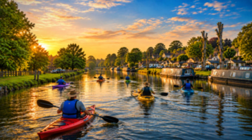
This attractive 9.5 mile circular kayaking route explores a beautiful stretch of the River Thames near Reading, including the historic village of Sonning, the secluded St Patrick’s Stream and the River Loddon.
Starting and finishing at Wokingham Waterside Centre, the route combines open stretches of the Thames with narrow, winding backwaters, historic bridges, attractive countryside and plenty of wildlife.
Unlike a straightforward Thames paddle, this route uses St Patrick’s Stream to create an interesting circular journey, avoiding the need to retrace the entire outward route.
Important: This is a moderate paddle requiring confidence on moving water. River conditions, particularly along St Patrick’s Stream, can change considerably following rainfall.
THE ROUTE
Click on the items along the route for more info and what3word links.
Download the gpx file for your Garmin watch here.
Import the GPX into Garmin Connect as a course, select the appropriate activity type, then send it to your watch.


ROUTE IN DETAIL
GETTING IN / OUT AND PARKING
Amble free street parking here. Just double check there is no 'park run' planned.
Cars cannot be left there between 7:30 and 10:30 am or 4:30 to 5:30pm weekdays.
You can pay to park and paddle by contacting Wokingham Waterside Centre,
Once parked walk over the large open field and put it on the slipway next to the waterside centre.
There was no charge when we went.
SECTION 1 – WOKINGHAM WATERSIDE CENTRE TO SONNING LOCK
DREADNOUGHT REACH
Leaving the waterside centre, turn downstream towards Sonning Lock.
This stretch of the Thames is known as Dreadnought Reach and provides an attractive introduction to the paddle.
The river is relatively broad here, with a mixture of open water, trees and countryside. On your left, you’ll pass the Caversham Lakes area, including the Redgrave-Pinsent Rowing Lake. The rowing lake was created through gravel extraction and subsequent restoration of the surrounding landscape.
Keep an eye out for rowing boats and other river traffic.
SONNING LOCK
https://what3words.com/shed.oasis.inch
Sonning Lock is one of the prettiest locks on this section of the Thames. Surrounded by attractive riverside scenery, it makes an excellent place to pause before continuing downstream. There should be a clearly marked canoe portage on the right-hand side when approaching downstream.There is a short carry around the lock, with a re-entry point immediately below.
SECTION 2 – SONNING BRIDGE & VILLAGE
https://what3words.com/else.lushly.sweated
Immediately below Sonning Lock, you’ll paddle beneath the beautiful Sonning Bridge. This historic brick bridge was completed in 1775, replacing an earlier wooden structure. The bridge is particularly distinctive because its roadway is narrow enough to require traffic lights to control vehicles crossing.
For us kayakers, the brick arches and surrounding riverside buildings make this one of the most photogenic parts of the trip. Look out for the fun modern art often located on the bridge by a local artist.
SECTION 3 – SONNING TO ST. PATRICK’S STREAM
Leaving Sonning behind, the Thames becomes increasingly rural. The river passes attractive properties, open countryside and wooded banks.
ST PATRICK’S STREAM ENTRANCE
https://what3words.com/ranged.bridges.relief
Approximately 1.5 miles downstream from Sonning, look for the entrance to St Patrick’s Stream on the right.
The entrance is identified by two wooden markers and a notice warning that the stream is unsuitable for launches.
The entrance requires particular attention. The can be a shallow lip towards the right-hand side, which can damage under-stern rudders.
Paddlers should also watch for shallow water, submerged obstacles and overhanging branches.
SECTION 4 – ST.PATRICK’S STREAM
THE HIGHLIGHT OF THE PADDLE
St Patrick’s Stream is arguably the most interesting section of this circular route.
The stream winds through beautiful Berkshire countryside, offering a completely different paddling experience from the main Thames.
The waterway becomes narrower, with trees, vegetation and natural riverbanks creating a secluded atmosphere.
There are occasional riverside houses, but much of the route feels wonderfully peaceful.
THE STREAM
St Patrick’s Stream bypasses part of the main Thames navigation and drops approximately five feet over roughly two miles. This creates a natural downstream current.
Under suitable conditions, the gentle movement of the water makes for an enjoyable journey through the countryside.
However, the stream can become significantly more challenging following heavy rainfall.
Overhanging branches, fallen trees and other obstructions may present hazards, particularly when the current is running quickly.
This is not a section to attempt during strong flows or when Thames navigation warnings are in force.
STREAM JUNCTION
https://what3words.com/minder.destined.apart
Approximately two-thirds of the way along St Patrick’s Stream, another smaller watercourse joins from the left.
The original guide identifies a small weir a short distance upstream along this tributary.
Avoid approaching or attempting the weir without specific local knowledge and a safe inspection.
Continue along the main stream towards its junction with the River Loddon.
SECTION 5 – RIVER LODDON TO SHIPLAKE LOCK
https://what3words.com/giggled.senses.lifetimes
Towards the end of St Patrick’s Stream, the waterway joins the River Loddon. This short section provides another change of scenery before returning to the main Thames.
Follow the Loddon downstream until it meets the Thames just below Shiplake Lock. At the junction, turn upstream towards Shiplake Lock. The return journey now begins in earnest.
SHIPLAKE LOCK
Shiplake Lock is another attractive Thames lock with an interesting history.
Approach the lock via the left-hand channel heading towards the weir and you will come to a floating pontoon on the right. Marked here. It was all operational in October 2026 when we last paddled it.
From here, paddlers carried their boats across the island before relaunching near the lock, no more than 50 yards.
SECTION 6 – SHIPLAKE TO SONNING
Leaving Shiplake Lock, continue upstream along the River Thames.
This section takes you past Shiplake College, which sits beside the river. The surrounding landscape includes attractive countryside, riverside properties and mature trees. Eventually, you’ll pass the entrance to St Patrick’s Stream again.
This time, continue along the main Thames towards Sonning.
PADDLING UPSTREAM
Unlike the outward journey, this section involves paddling against the Thames current. Under normal summer conditions, this may be relatively straightforward for reasonably experienced paddlers.
However, even moderate increases in river flow can make upstream progress considerably more demanding. Allow sufficient time and energy for the return journey.
SECTION 7 – SONNING TO WOKINGHAM WATERSIDE CENTRE
Continue upstream beneath Sonning Bridge. You’ll then need to negotiate Sonning Lock again, following the appropriate portage arrangements.
Once above the lock, retrace your outward route along Dreadnought Reach.
Pass the Caversham Lakes area before returning to Wokingham Waterside Centre.
This completes the circular paddle. Do let me know how you got on...
KEY PADDLE
INFO
DISTANCE:
Approximately 15.29km / 9.5miles
JOURNEY TIME:
4 - 5 hours moving time.
DIFFICULTY:
Moderate
WATER TYPE:
Navigable river and natural stream
NAVIGATION AUTHORITY:
Environment Agency
SUITABLE FOR:
Experienced recreational kayakers and canoeists.
NUMBER OF LOCKS:
Two but one is portaged twice.
CURRENT:Variable; stronger after rainfall.
BEST SEASON TO PADDLE:
Spring to early summer in suitable conditions
SUITABLE FOR BEGINNERS?:
Recommended for experienced paddlers.
RIVER CHARACTER
WOKINGHAM → SONNING
Broad, navigable Thames with rowing activity, riverside scenery and relatively open surroundings.
SONNING → ST PATRICK’S STREAM
Attractive countryside, historic Sonning Bridge and increasingly rural riverbanks.
ST PATRICK’S STREAM
Narrow, winding natural waterway with overhanging vegetation, wildlife and a downstream current.
RIVER LODDON → SHIPLAKE
Short connecting section returning to the Thames, followed by Shiplake Lock.
SHIPLAKE → WOKINGHAM
Upstream Thames paddling, historic landmarks and a return through Sonning.
HISTORIC HIGHLIGHTS
This relatively short circular paddle includes several interesting historic landmarks.
SONNING BRIDGE – 1775
The distinctive brick bridge replaced an earlier wooden crossing and remains one of Sonning’s best-known landmarks.
THE MILL AT SONNING
A historic riverside mill that has been adapted into a dinner theatre.
ST PATRICK’S STREAM
A natural Thames backwater offering an alternative route around part of the main navigation.
SHIPLAKE LOCK ISLAND
A historic camping community with roots in the nineteenth century.
SHIPLAKE COLLEGE
An established independent school occupying an attractive riverside setting.

LICENSE REQUIRED?
YES
A waterways licence is required for paddling on the managed River Thames navigation.
A Paddle UK membership can provide the relevant waterways licence.
MOBILE PHONE SIGNAL
Mobile coverage should generally be reasonable around Reading, Sonning .
Coverage will be less reliable along St Patrick’s Stream.
Download your route map before setting off.
WEATHER AND FLOW
TOM'S TOP TIPS

MAKE THE MOST OF ST PATRICK’S STREAM
This is the standout section of the trip. Allow plenty of time to enjoy the scenery and wildlife rather than rushing through.
LOOK OUT FOR THE COOL ART ON SONNING BRIDGE
There is often quirky modern art attached to the London side of Sonning bridge by a local artist.
SAVE SOME ENERGY FOR THE RETURN
The final part of the trip involves paddling upstream along the Thames. Allow for this when planning your journey.
RIVER THAMES RELATED WEBSITES


RIVER THAMES KAYAK / PADDLE EVENTS
RELATED VIDEOS
MORE COMING SOON